- Home
- About Us
- GAINS
- News/TAG Webinars
- Membership
- Annual Meeting/SAGEEP
- SAGEEP 2026
- SAGEEP 2026 Schedule at a Glance
- SAGEEP 2026 Outdoor Demonstrations
- SAGEEP 2026 Registration Information
- SAGEEP 2026 Abstract/Session Schedule
- SAGEEP 2026 Sponsorship Opportunities
- SAGEEP 2026 Exhibitor Opportunities
- SAGEEP 2026 Exhibitor Contract
- SAGEEP 2026 Accommodations
- SAGEEP 2026 Short Coures
- SAGEEP 2026 Luncheons/Conference Events/Activities
- SAGEEP 2025
- SAGEEP 2025-Munitions Response Meeting Abstracts/Sessions
- SAGEEP 2025-MRM Exhibiting/Sponsorship Opportunities
- SAGEEP 2025-MRM Accommodations
- SAGEEP 2025-MRM Registration Information
- SAGEEP 2025-MRM Program
- SAGEEP 2025-Munitions Response Meeting Short Courses
- SAGEEP 2025/MRM Luncheons/Conference Events/Activities
- SAGEEP 2024
- SAGEEP 2023
- SAGEEP 2022
- SAGEEP 2021
- SAGEEP 2020 Exhibiting/Sponsorship
- SAGEEP-2019
- SAGEEP 2019 Exhibiting/Sponsorship
- SAGEEP 2018
- SAGEEP 2017
- SAGEEP 2016
- SAGEEP 2015
- Proceedings SAGEEP 2024
- Proceedings SAGEEP 2023
- Proceedings SAGEEP 2022
- Proceedings SAGEEP 2018
- Proceedings SAGEEP 2025
- Proceedings SAGEEP 2026
- SAGEEP 2026
- Publications & Merchandise
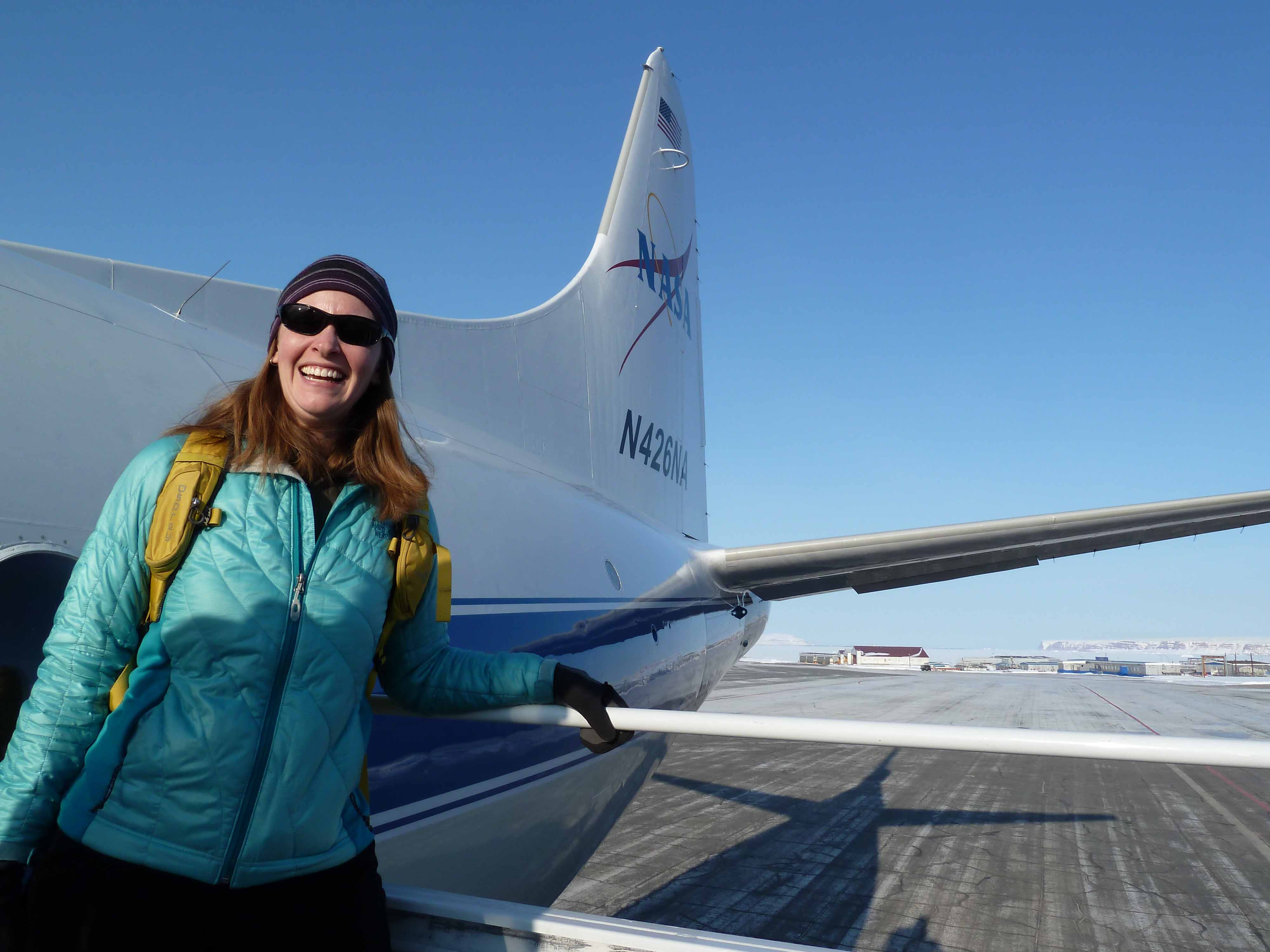
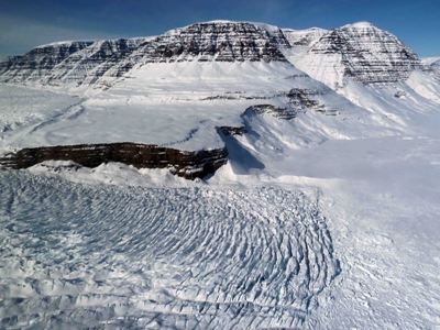
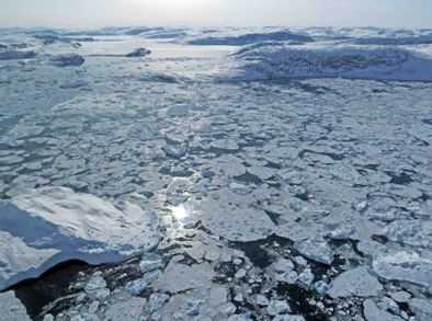
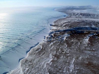
Photos from the FieldWhere in the world are EEGS members and what are they working on?Each month, EEGS member projects are featured. Submit projects to "Photos from the Field" at [email protected]. September, 2013 An Airborne Mission for Polar Ice – Greenland and AntarcticaBethany L. Burton; USGS NASA’s Operation IceBridge is a multi-year project that is monitoring changes in Arctic and Antarctic polar ice, including ice sheets, sea ice, and glaciers, to provide a high-resolution suite of data to aid in the prediction of its response to climate change. The data from this project is providing continuity in polar observations between NASA’s Ice, Cloud and Land Elevation Satellite (ICESat), in orbit since 2003 and decommissioned in 2009, and ICESat-2, plannedfor launch in early 2016. Several research aircraft with multiple instruments that measure ice elevation and thickness, snow depth, surface temperature, bedrock topography, and underlying geology are involved, and all raw and processed datasets are available for download through the National Snow and Ice Data Center (NSIDC).
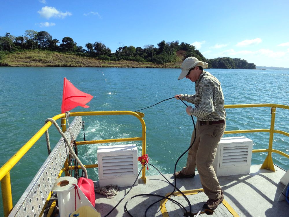
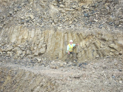
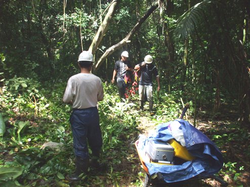
I’ve been involved with the magnetometer onboard the P-3B aircraft during the spring 2011 and 2012 Greenland campaigns as well as the upcoming Antarctic cacampaign this fall. Greenland operations are based out of Thule Air Force Base in northwest Greenland and Kangerlussuaq, along the central west coast. The P-3B aircraft includes several different radar systems, laser altimeters, a surface temperature instrument, an aerial photography system, a gravimeter, and a magnetometer. The main purpose of the magnetic data is to supplement the radar and gravity data in mapping the bedrock topography in areas where massive crevassing scatters the radar signal and in mapping bathymetry below glacier tongues where the signal losses are high due to the conductive sea water. On each eight-hour survey flight, as an onboard instrument operator, I monitor the data acquisition, process data, discuss observations with other operators, and enjoy the scenery. With a survey altitude of 1,500 ft above ground level, the views along glacier runs and along the coastlines are incredible. This project has been a great opportunity to work with other scientists and engineers from different disciplines and to learn more about polar science, a much different application for me as compared to my typical near surface projects. Panama Canal - Third Set of Locks
Project
|
Our Corporate Members


Quick Links
- My Profile
- Join or Renew EEGS Membership
- EEGS Foundation
- GAINS Virtual Training Course
- SAGEEP 2026
- Advertise in FastTIMES
- Corporate Members
- EEGS Online Research Library
- FastTIMES Submissions
- JEEG Submissions
- Geophysics Careers
- Geophysics Careers - Resumes
- Membership Renewal/EEGS Foundation Contribution
- Donate to the TAG (Talk About Geophysics) Webinar Program
- Student Chapters
- American Geoscience Institute (AGI) News
- TAG Webinars - Talk About Geophysics!
- Write to EEGS
Upcoming Events
SEGJ 16th International Symposium
September 27–30, 2026
Sapporo, Japan
Deadline to Submit Abstracts: May 18, 2026
https://sites.google.com/segj.org/is-16th/submission